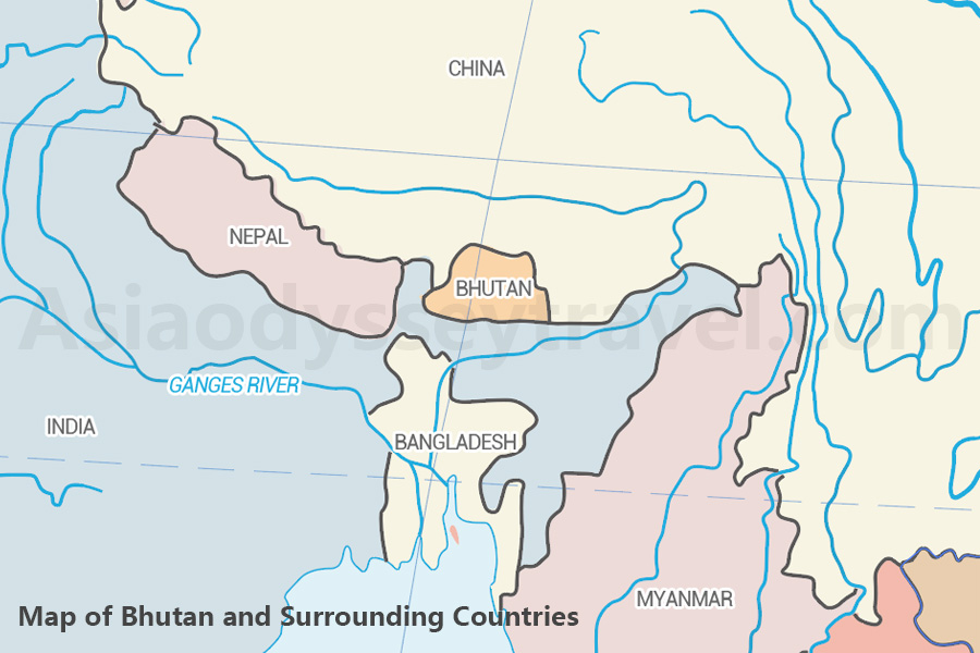
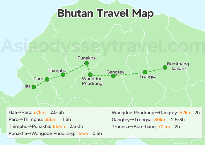
Bhutan Travel Map from Paro
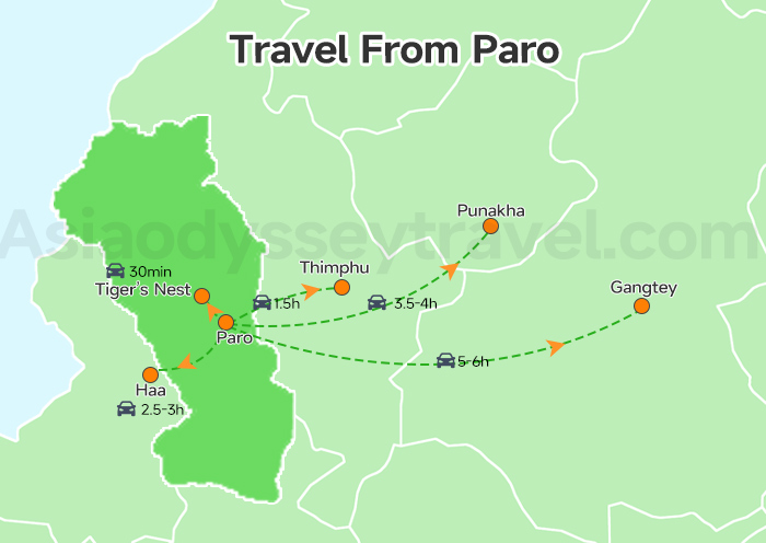
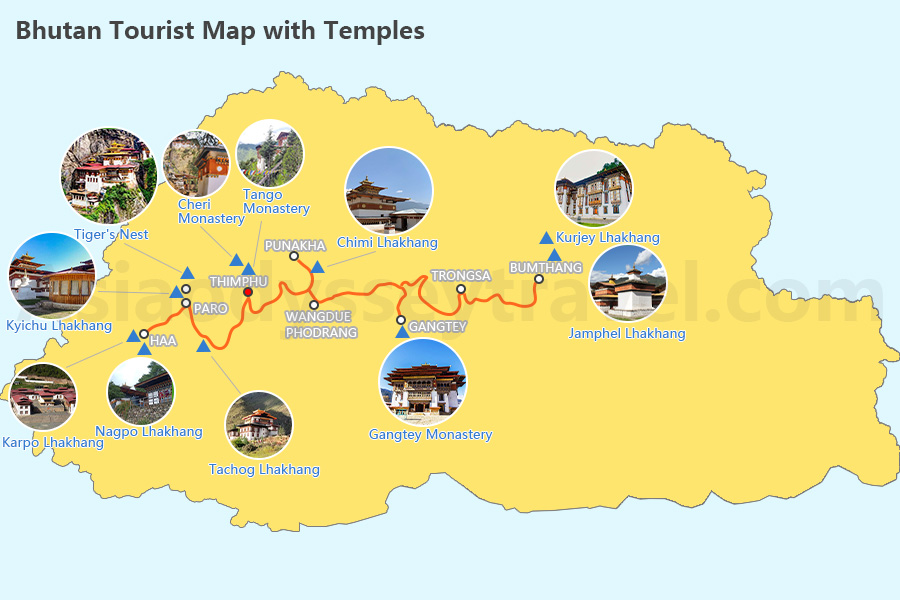
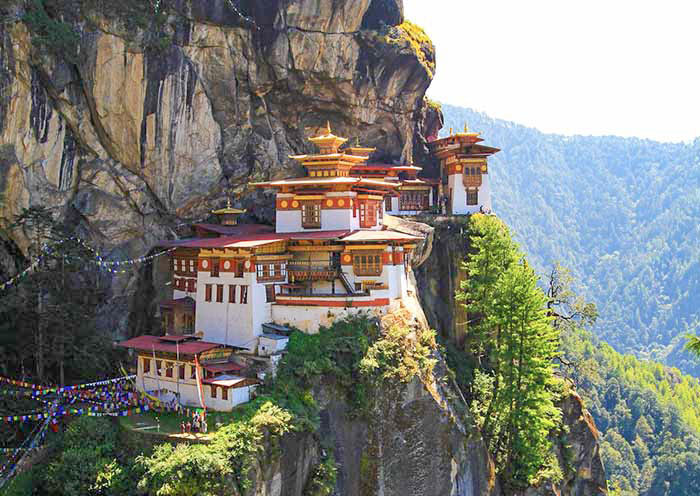
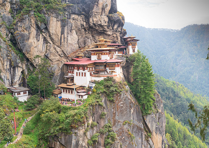
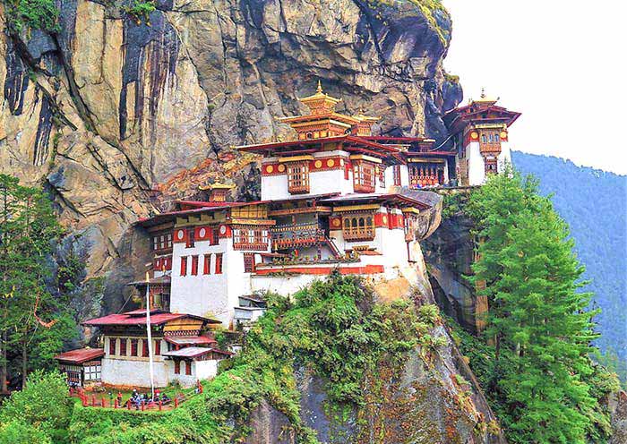
Most journeys through Bhutan begin in Paro, home to the country’s only international airport and the legendary Tiger’s Nest Monastery. From this peaceful valley town, travelers can easily venture out to Bhutan’s must-see destinations.
Paro to Thimphu Map
The journey from Paro to Thimphu is about 55 kilometers and takes about 1.5 hours by car. It’s a scenic drive through gurgling rivers, rolling hills, traditional Bhutanese homes, and views of terraced fields.
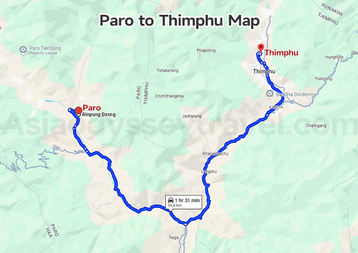
This Paro to Thimphu Map clears the winding mountain roads with duration and length, as well as some pictures of distinctive spots, including:
- Tamchog Lhakhang Iron Bridge: An ancient iron chain bridge and picturesque riverside temple.
- Paro Chhu and Thimphu Chhu Confluence: A photogenic stop where two rivers meet.
Paro to Tiger’s Nest Temple (Taktsang Monastery) Map
From Paro town, it's a 30-minute drive (about 13 kilometers) to the base of the hike to the Tiger’s Nest Monastery. From there, the hike to the monastery takes 2-3 hours uphill, depending on your pace, and another 1.5 hours to descend.
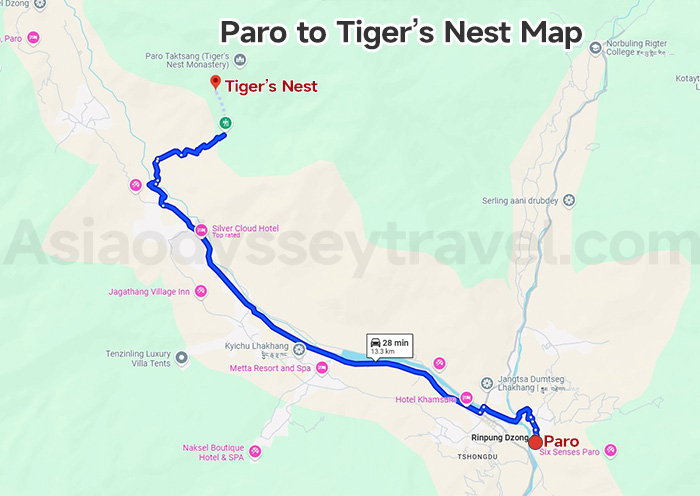
The Paro to Tiger’s Nest Temple Map shows both driving route and hiking route.
Along the drive, you’ll come across the Kyichu Lhakhang, one of Bhutan’s oldest and most sacred temples.
The hiking trail offers sweeping views of the Paro Valley. The halfway teahouse is an important stop for lunch and a direct view of the cliffside monastery.
Paro to Punakha Map
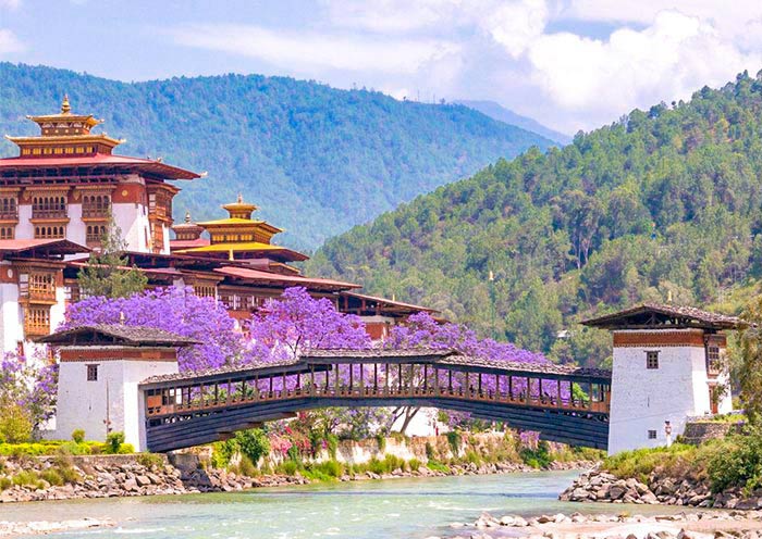
The journey from Paro to Punakha is about 120 kilometers and takes around 3.5 to 4 hours by car. The drive first passes through Thimphu and then climbs up to Dochula Pass, and finally reach Punakha.
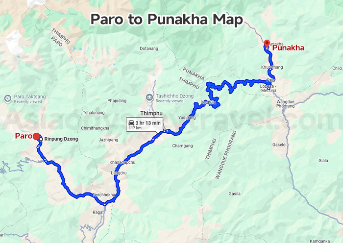
This Paro to Punakha Map offers the winding roads, as well as pictures of popular spots along the drive, including:
- Thimphu: The capital city with various attractions like Tashichho Dzong, Buddha Dordenma, and National Memorial Chorten.
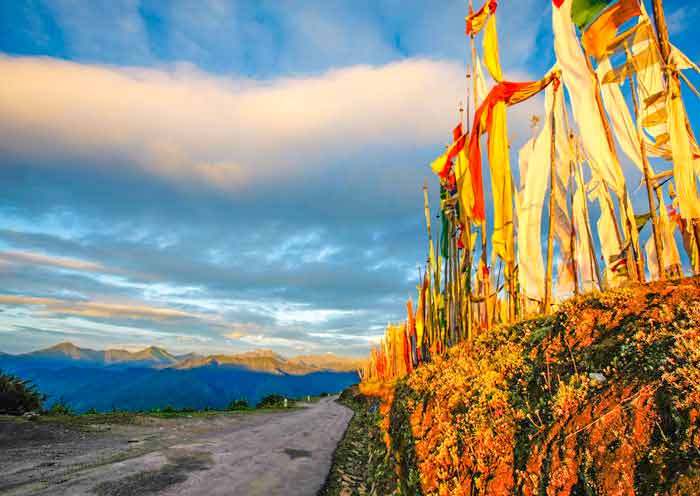
- Dochula Pass (3,100m): The most famous pass in Bhutan to enjoy panoramic views of the Himalayan peaks on a clear day. The pass is also home to the 108 memorial chortens.
Paro to Gangtey (Phobjikha Valley) Map
The road from Paro to Gangtey (Phobjikha Valley) covers roughly 175 kilometers and takes about 5 to 6 hours, depending on road conditions.
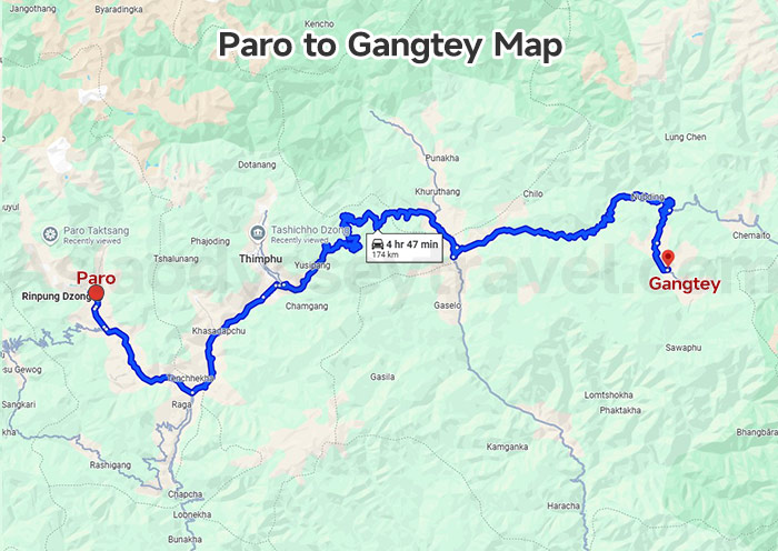
Look at the Paro to Gangtey Map, you can clearly see that the route overlaps with the drive to Punakha, passing through Thimphu and over Dochula Pass. After descending into the Punakha Valley, the journey continues eastward through Wangdue Phodrang to Phobjikha Valley.
Through the map, you can also catch a glimps of the passingby attractions below:
- Rice Terraces in Punakha Valley: The terraced fields cascade down the hillsides, creating a stunning green tapestry against the backdrop of the valley's mountains.
- Wangdue Phodrang Dzong (under reconstruction since 2012 fire): The Dzong overlooks the confluence of the Punatsangchu and Dangchu rivers.
Paro to Haa Map
Paro to Haa is a short but scenic drive of about 67 kilometers, typically taking 2.5 to 3 hours.
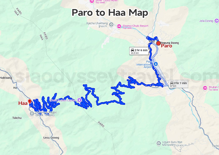
From this map you can see how winding the road from Paro to Haa is. The route climbs steadily to cross Chele La Pass (3,988m), offering incredible views of Mount Jomolhari on clear days.
After the pass, the road descends sharply into the Haa Valley. The valley is known for its authentic atmosphere, charming villages, and the sacred Lhakhang Karpo and Lhakhang Nagpo temples. It’s a great detour if you’re seeking solitude and off-the-beaten-path cultural experiences.
Bhutan Travel Map from Thimphu
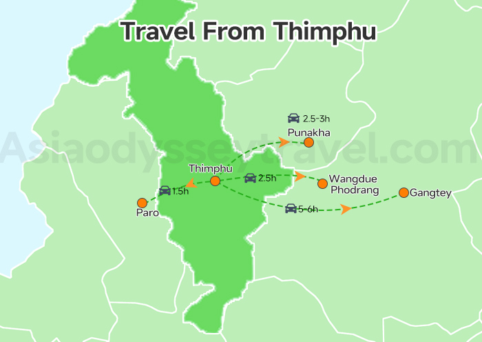
Thimphu, Bhutan’s vibrant capital, is often the second stop on a classic Bhutan itinerary. From here, you can journey deeper into western and central Bhutan through mountain passes, valleys, and riverside villages.
Thimphu to Punakha Map
The drive from Thimphu to Punakha spans about 85 kilometers and typically takes around 2.5 to 3 hours, as offered in the following map.
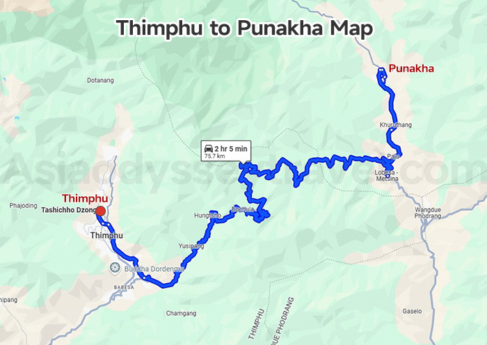
The journey begins with a gradual climb up to the scenic Dochula Pass. After Dochula, the road winds downhill into the subtropical Punakha Valley. As you enter Punakha, you’re welcomed by lush rice terraces and the iconic Punakha Dzong.
Thimphu to Wangdue Phodrang Map
The distance from Thimphu to Wangdue Phodrang is around 70 kilometers, with a drive time of approximately 2.5 hours.
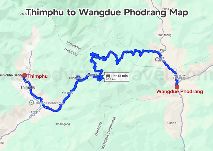
From the map, you can see that this route overlaps with the first part of the Thimphu–Punakha road. As you drive further east beyond the Punakha turnoff, the road leads to the town of Wangdue Phodrang.
It's a good place to pause and explore the surrounding villages before heading toward more remote destinations like Gangtey or Bumthang.
Thimphu to Gangtey (Phobjikha Valley) Map
Traveling from Thimphu to Gangtey (Phobjikha Valley) covers a distance of about 140 kilometers and takes roughly 5 to 6 hours by car.
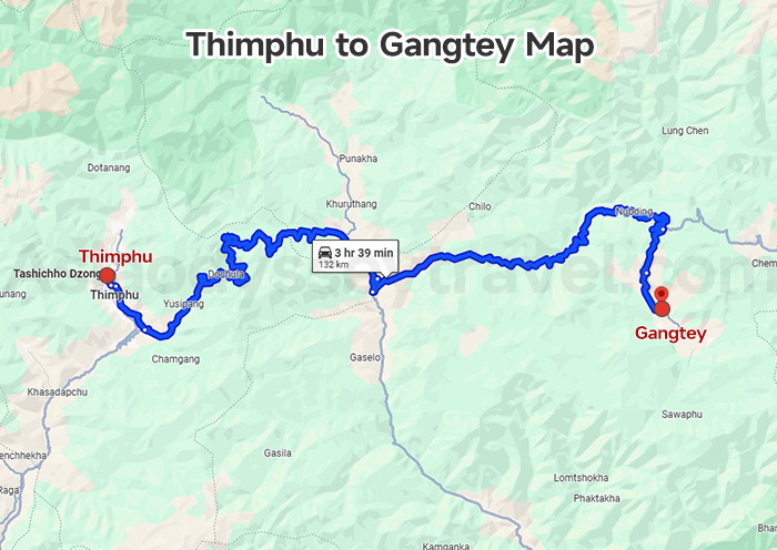
From the map, you’ll find the route follows the same road as the Thimphu–Punakha–Wangdue journey. From Wangdue, the road climbs again, winding through the Black Mountains and offering dramatic mountain scenery with occasional waterfalls and forested cliffs.
Bhutan Travel Map from Punakha
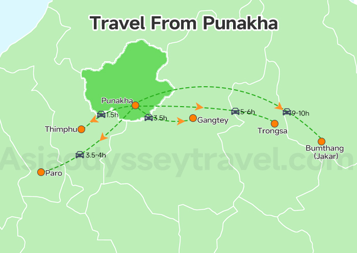
Once you’ve explored the iconic Punakha Dzong and strolled through rice paddies and riverside villages, it’s time to head further east. Our Bhutan Travel Map from Punakha outlines two rewarding journeys that take you deeper into Bhutan’s countryside.
Punakha to Gangtey Map
Traveling from Punakha to Gangtey (Phobjikha Valley) is one of Bhutan’s most scenic drives. The journey spans approximately 80 kilometers and takes about 3.5 to 4 hours by car.
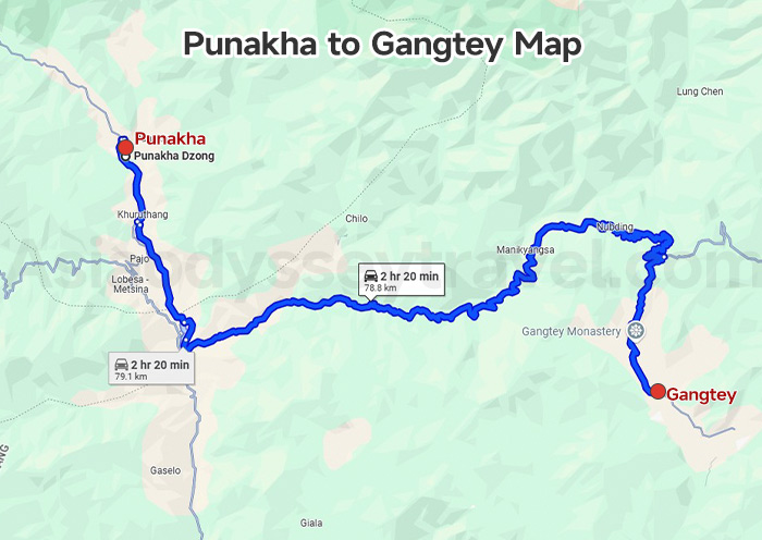
Look at the map, the route from Punakha to Gangtey passes through Wangdue Phodrang before turning east and then south after Lawa La Pass, leading to the Phobjikha Valley where Gangtey Monastery is situated.
Punakha to Trongsa Map
Traveling from Punakha to Trongsa is a scenic and essential leg of any journey deeper into central Bhutan. The route covers approximately 129 kilometers and typically takes around 5 to 6 hours by car.
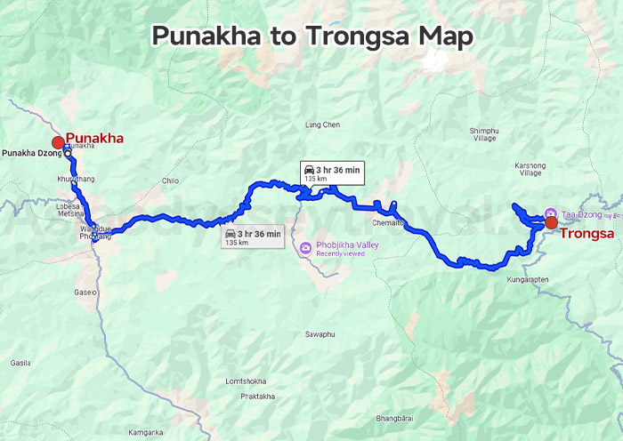
Look at the map, and you'll see the road winds eastward from Punakha, passing through Wangdue Phodrang before climbing up to Pele La Pass (3,420m), which marks the boundary between western and central Bhutan.
After crossing Pele La, the route descends through lush forests and mountain valleys toward the charming town of Trongsa. Situated on a hillside, Trongsa is famous for its massive Trongsa Dzong, one of the most impressive fortresses in Bhutan, historically serving as a key seat of power.
Punakha to Bumthang Map
The journey from Punakha to Bumthang takes you deep into central Bhutan, covering around 215 kilometers over 9 hours of driving. It’s quite a long drive, so we usually make a stop at Gangtey.
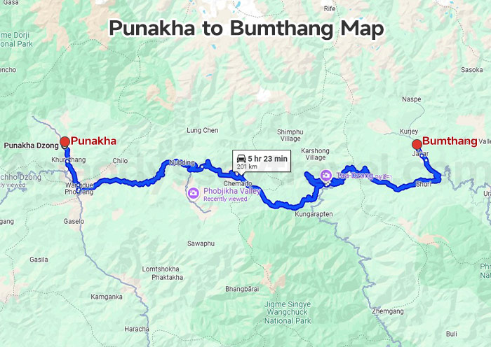
Look at the map, from Gangtey to Bumthang, you'll first retrace the route to Lawa La Pass before continuing eastward through the rural district of Trongsa, a popular midway point for rest and exploration.
From Trongsa, the road climbs again through Yotong La Pass (3,425m) before descending into the Bumthang Valley—Bhutan’s spiritual heartland.
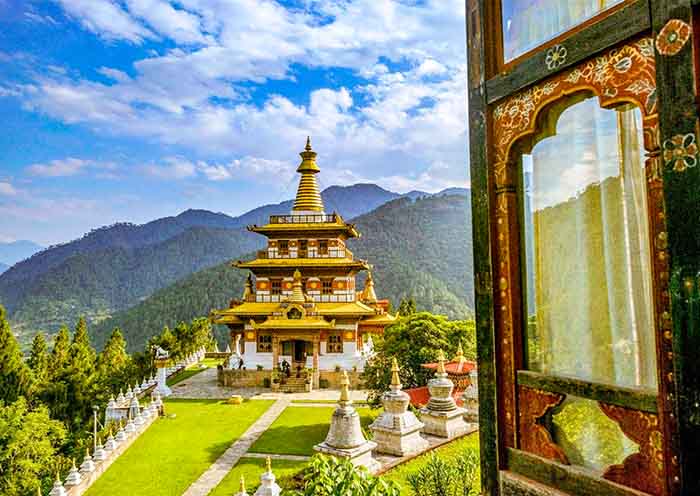
Bumthang is famous for its sacred temples, monasteries, and traditional festivals, making it a deeply rewarding destination for cultural travelers.
Bhutan Travel Map with Distance and Travel Time
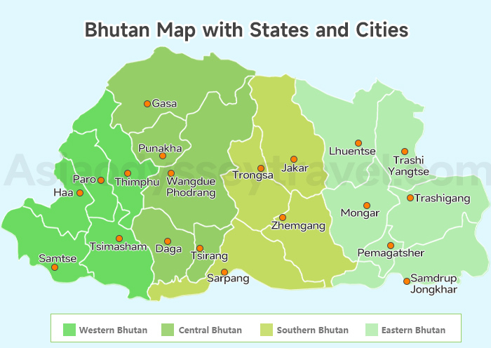
Planning a trip to Bhutan is refreshingly simple. Most routes follow a west-to-east loop that begins and ends in Paro, Bhutan’s only international gateway. A detour west to the hidden valley of Haa is also possible, typically done as a day trip from Paro at the end or starting of the tour.
With our above Bhutan travel maps showing the distances and highlights between cities, organizing your itinerary is easier than ever.
This map shows the travel duration in top destinations in Bhutan and the one-way travel time between them.
If you have 4 to 6 days, your journey will likely focus on Bhutan’s western wonders—Paro, Thimphu, and Punakha. You’ll hike to the legendary Tiger’s Nest Monastery, explore Bhutan’s vibrant capital, and discover the stunning riverside fortress of Punakha Dzong, all within a relaxed travel pace.
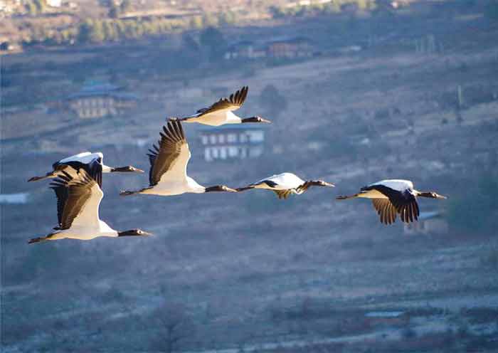
With 7 to 9 days, you can continue your adventure eastward to the Phobjikha Valley (Gangtey). This serene glacial valley is home to Gangtey Monastery and the rare black-necked cranes in winter. Or you can add the less-visited Haa Valley into your trip.
For trips over 10 days, you can venture further into central Bhutan, reaching the sacred Bumthang Valley, a region filled with ancient temples, peaceful forests, and Bhutanese spiritual heritage. This deeper journey provides a fuller cultural immersion.
In each destination, one day is enough to explore the regular attractions and you even have the opportunity to try a light hike of about 1 hour.
| Start Point | Destination | Duration (Approx.) |
|---|---|---|
| Paro | Thimphu | 1 hour |
| Tiger’s Nest Temple | 20–30 mins to trailhead | |
| Punakha | 3.5–4 hours via Dochula Pass | |
| Gangtey (Phobjikha) | 5.5–6 hours | |
| Haa | 2.5–3 hours via Chele La Pass | |
| Thimphu | Punakha | 2.5–3 hours via Dochula Pass |
| Wangdue Phodrang | 3–3.5 hours | |
| Gangtey (Phobjikha) | 5–5.5 hours | |
| Punakha | Gangtey (Phobjikha) | 3 hours |
| Bumthang | 8–9 hours (or overnight stop) |
When traveling in Bhutan, you will spend more time on the road, but believe me, it is all worth it. The pristine valleys, traditional villages, quaint castles, gurgling rivers and sacred temples will fill your journey and it will not be boring at all.
Explore Bhutan with Local-based Asia Odyssey Travel
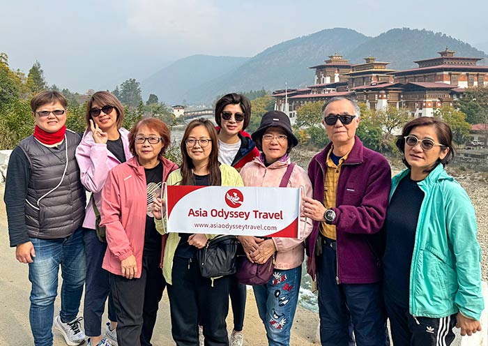
Asia Odyssey Travel is a local-based travel agency that offers Bhutan Group Tours and customized tours in Bhutan. Our team of experienced local guides ensures that you have an immersive and insightful journey, sharing our deep understanding of Bhutanese culture, history, and spirituality.
Bhutan, known as the "Land of the Thunder Dragon," is a captivating destination with its stunning landscapes, ancient monasteries, and rich Buddhist traditions. Asia Odyssey Travel can help you discover the highlights of Bhutan, including Paro, Punakha, Thimphu, Bumthang, and Gangtey.
Whether you're interested in trekking through pristine mountain trails, participating in vibrant festivals, or exploring remote villages, Asia Odyssey Travel can tailor Bhutan Trekking Tour and Bhutan Festival Tour itineraries to suit your preferences.
Embark on a memorable journey through Bhutan with Asia Odyssey Travel and immerse yourself in the enchanting beauty and traditions of this unique Himalayan kingdom.
For useful links when planning a trip to Bhutan, click here:
Bhutan Travel Tips:
How to Visit Bhutan: How to Plan a Trip to Bhutan?
The Cost of Traveling in Bhutan
Bhutan Hotels: Unlock Happiness During Your Stay in Bhutan
Visa & SDF in Bhutan:
Bhutan Visa: Requirements, Price, Policy
Bhutan Tourist Tax: Bhutan's SDF Fee Promoting Happiness
Bhutan Travel Restrictions: Bhutan Travel Rules
Bhutan Attractions:
10 Best Places to Visit in Bhutan
20 Best Things to Do in Bhutan
Top 7 Valleys in Bhutan to Visit
Top 10 Thimphu Tourist Places to Visit
Transportation Tips:
Flights to Bhutan: How to Fly to Bhutan
Bhutan Airports: Paro Airport & List of Airport in Bhutan
How to Travel to Bhutan from USA
How to Get to Bhutan from Singapore
How to Get to Bhutan from Nepal