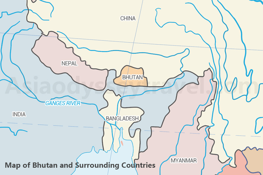
Bhutan Map with States and Cities
Let's take a look at what fascinating places there are in this tiny but amazing kingdom.
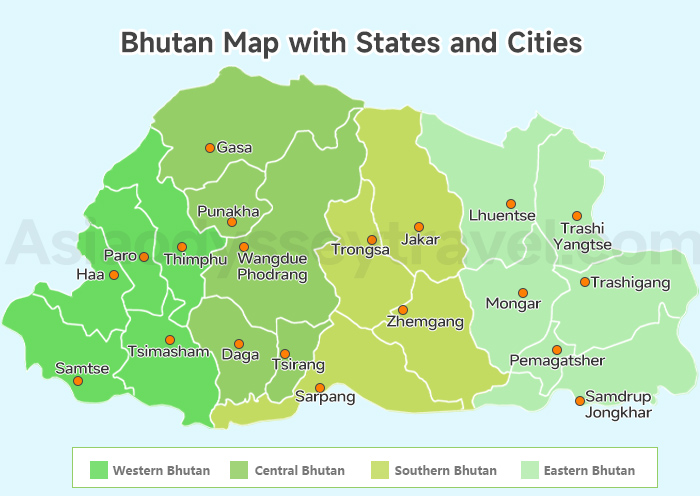
1. Western Bhutan - The Cultural Gateway
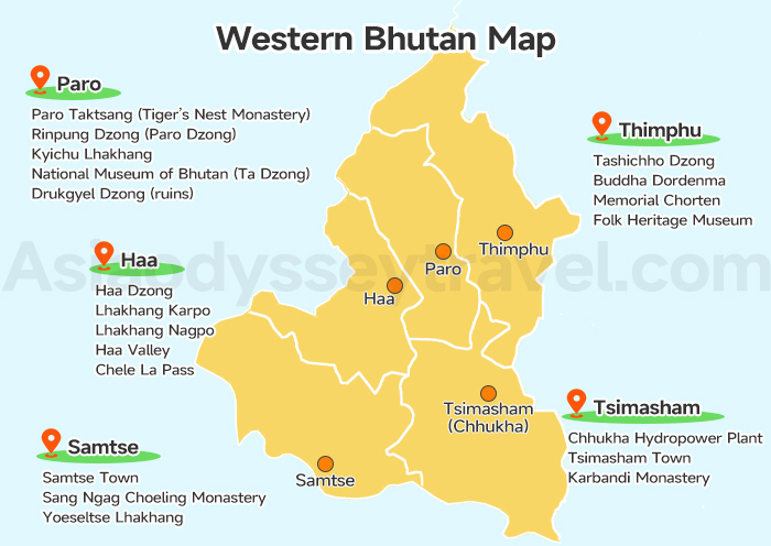
Districts: Paro, Thimphu, Punakha, Haa, Samtse, Chhukha (Tshimasham)
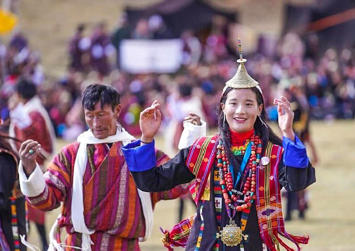
Western Bhutan is where most journeys begin — it's home to Bhutan's only international airport (Paro) and its vibrant capital (Thimphu). This region blends ancient monasteries, royal palaces, scenic valleys, and lively markets.
From the map, you can see the following Highlights:
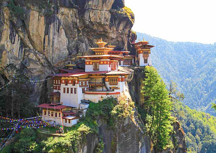
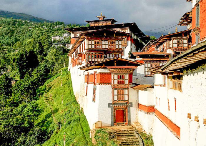
- Paro - Hike to Tiger's Nest (Taktsang), visit Paro Dzong, and explore valley villages.
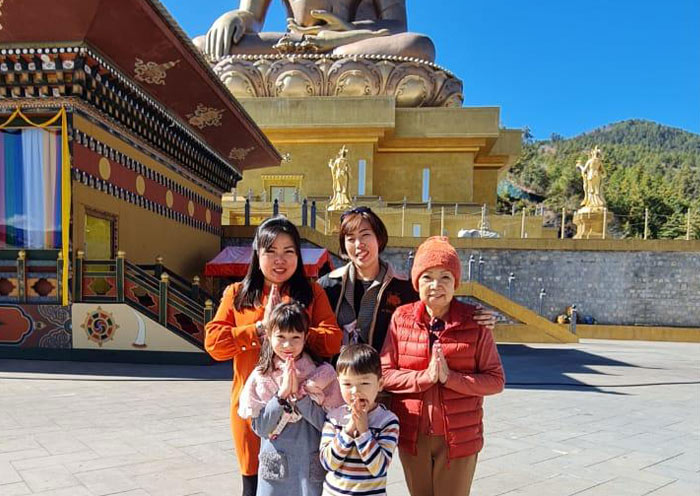
- Thimphu - Bhutan's modern capital with national museums, Buddha Dordenma, and handicraft markets.
- Punakha - Former capital known for the majestic Punakha Dzong and riverside views.
- Haa Valley - Less touristy, serene valley perfect for hikes and cultural immersion.
- Chhukha - Gateway district with scenic roads and local town Tshimasham.
Tourist Tip: Spend at least 4-6 days in this region. Great for history, scenery, and easier access.
2. Central Bhutan - Spiritual Heartland & Mountain Valleys
Districts: Trongsa, Bumthang (Jakar), Wangdue Phodrang, Gasa, Tsirang, Dagana
Known as Bhutan's spiritual core, Central Bhutan is dotted with sacred temples, historical dzongs, and lush mountain scenery. It's perfect for cultural explorers and those looking for off-the-beaten-track beauty.

From the map, you can see the following Highlights:
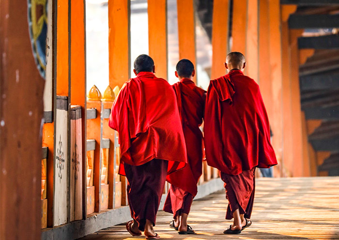
- Bumthang (Jakar) - Bhutan's spiritual hub with centuries-old temples like Jambay Lhakhang.
- Trongsa - Site of the grand Trongsa Dzong, ancestral home of the royal family.
- Gasa - Famous for remote trekking routes and natural hot springs.
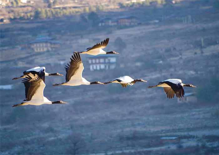
- Wangdue Phodrang - Scenic valleys and gateway to Phobjikha, home to black-necked cranes.
Tourist Tip: Allow time for travel between valleys; ideal for those interested in Bhutan's spiritual legacy and rural life.
3. Southern Bhutan - Tropical Foothills & Gateway Towns
Districts: Sarpang, Dagana, Tsirang, Samtse, Chhukha, Phuentsholing
Southern Bhutan sits along the Indian border, offering a subtropical climate, lush forests, and diverse cultural communities. It's also the land entry point for travelers coming from India.
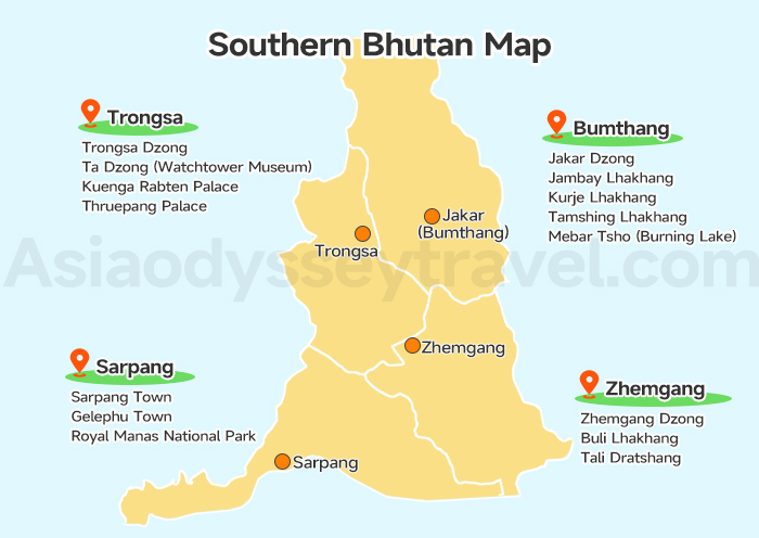
From the map, you can see the following Highlights:
- Phuentsholing - Main land border town with Indo-Bhutan blend and a bustling vibe.
- Sarpang & Samtse - Rich biodiversity, ethnic diversity, and quieter eco-tourism potential.
- Tsirang & Dagana - Rolling hills and peaceful agricultural landscapes.
Tourist Tip: Not a primary destination for most tourists, but great for overland travel or a quick glimpse of Bhutan's southern life.
4. Eastern Bhutan - Untouched & Culturally Distinct
Districts: Mongar, Trashigang, Trashiyangtse, Lhuentse, Pemagatshel, Samdrup Jongkhar
Eastern Bhutan is remote, rugged, and rarely visited — a hidden gem full of authentic traditions, textiles, and unspoiled nature. It offers a deep dive into Bhutanese heritage with fewer tourists.
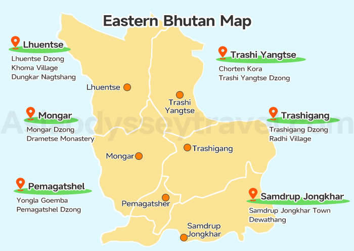
From the map, you can see the following Highlights:
- Trashigang - Largest eastern town, base for exploring highland communities.
- Lhuentse - Ancestral home of the royal family, famed for hand-woven textiles.
- Trashiyangtse - Artistic center known for traditional crafts and the sacred Chorten Kora.
- Mongar - Gateway to the east with beautiful ridges and dzongs perched on cliffs.
- Samdrup Jongkhar - Eastern land entry to India, a convenient route for overland tours.
Tourist Tip: Best suited for repeat travelers or cultural enthusiasts. You'll need extra travel time and a sense of adventure.
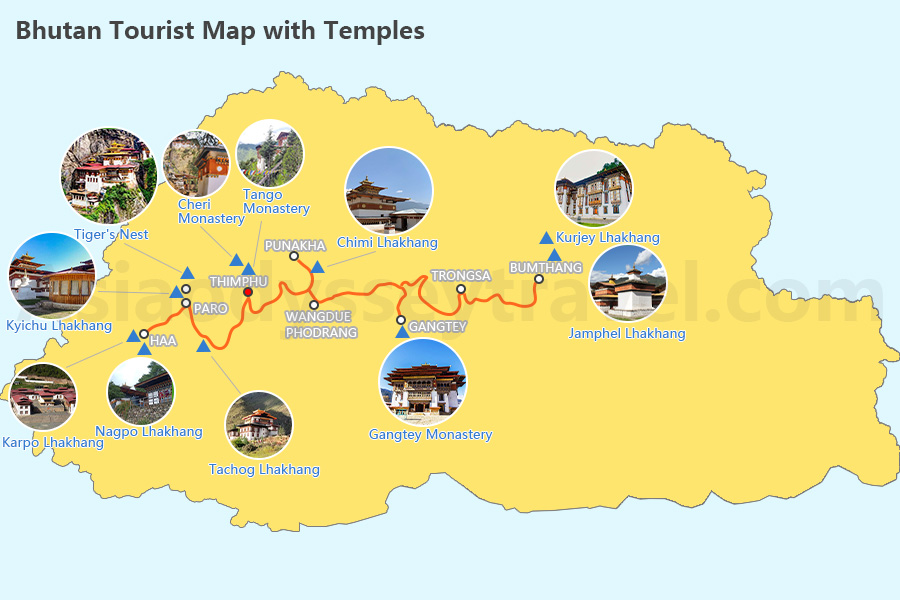
Want to know more details and information about Bhutan tourist attractions? Check out the Bhutan Tourist Map>>
Bhutan Airports Map with Flight Routes - How to Get to Bhutan by Air
Bhutan has limited international access by air due to its mountainous terrain—but that's what makes flying into Bhutan one of the most scenic air journeys in the world!
Main International Gateway: Paro International Airport (PBH)
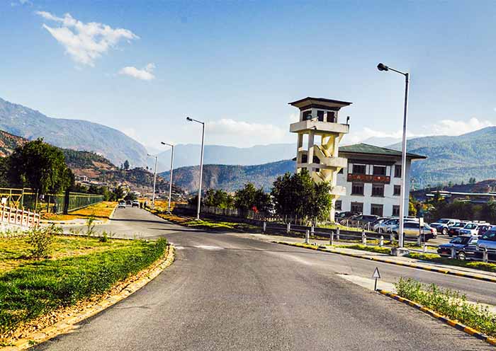
Location: Paro Valley, about 1 hour from Thimphu
Altitude: 2,235 meters (7,333 ft)
Note: This is the only international airport in Bhutan.
Famous for: One of the most challenging and breathtaking landings in the world, surrounded by Himalayan peaks.
Two Bhutanese airlines Druk Air (Royal Bhutan Airlines) and Bhutan Airlines operate several international flights connecting Paro with major cities in South Asia and Southeast Asia.
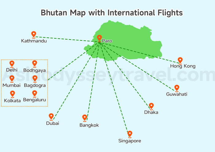
The map shows the location in Bhutan along with the connecting cities:
| City | Country | Notes |
|---|---|---|
| Bangkok | Thailand | Daily flights, most popular route |
| Kathmandu | Nepal | Short, scenic flight over the Himalayas |
| Delhi | India | Direct flights available |
| Kolkata | India | Often used for short transfers |
| Guwahati | India | Good option for Eastern India travelers |
| Singapore | Singapore | Less frequent, but convenient for Southeast Asia |
| Dhaka | Bangladesh | Short hop to Paro |
Domestic Airports in Bhutan
You can also choose a domestic flights to save travel time across Bhutan's mountainous roads, especially when you plan to explore more remote areas like Bumthang and eastern area.
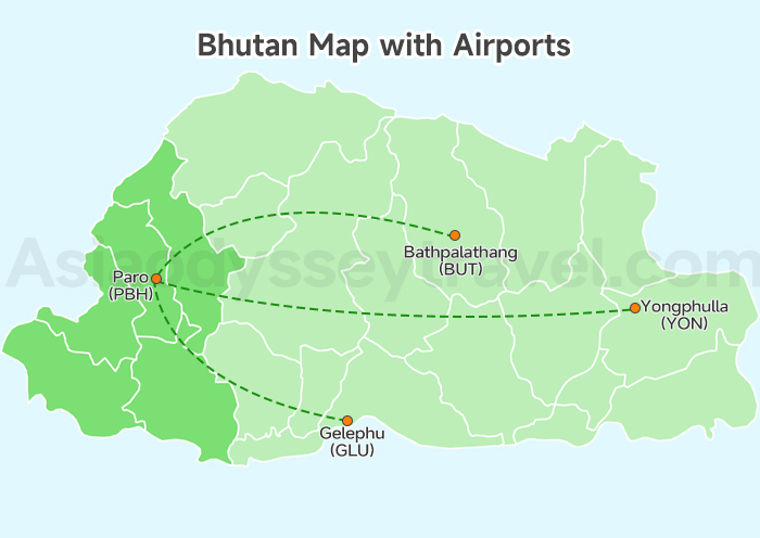
This map offers the popular domestic flights that you can choose in Bhutan.
| Airport | Location | Region |
|---|---|---|
| Bathpalathang Airport (BUT) | Bumthang | Central Bhutan |
| Gelephu Airport (GLU) | Sarpang | South-Central Bhutan |
| Yongphulla Airport (YON) | Trashigang | Eastern Bhutan |
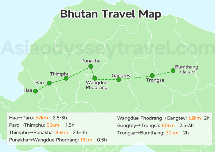
Bhutan Road Map with Distance - How to Travel Around Bhutan
Bhutan has one main highway that winds through mountains from west to east. While distances may look short on the map, travel can be slow due to winding roads and elevation changes. But the journey itself—through forests, valleys, and villages—is a big part of the experience.
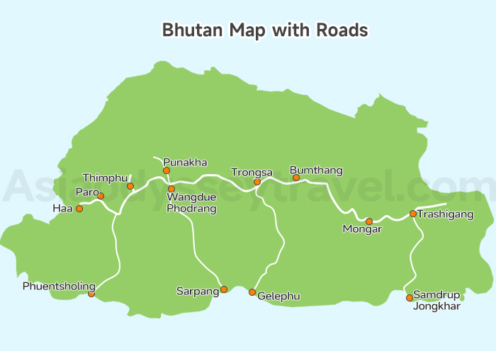
From the map, you can also see that Bhutan has four highways that winds through valleys from north to south.
Key Road Distances Between Major Towns (Approximate Driving Time Included)
| From - To | Distance | Drive Time |
|---|---|---|
| Haa - Paro | 67km | 2.5-3 hrs |
| Paro - Thimphu | 55 km | 1.5 hrs |
| Thimphu - Punakha | 85 km | 2.5-3 hrs |
| Punakha - Trongsa | 145 km | 5-6 hrs |
| Trongsa - Bumthang (Jakar) | 68 km | 2-3 hrs |
| Bumthang - Mongar | 198 km | 7-8 hrs |
| Mongar - Trashigang | 91 km | 3-4 hrs |
| Paro - Phuentsholing | 160 km | 5-6 hrs |
| Wangdue Phodrang - Sarpang | 150 km | 4-5 hrs |
| Trongsa - Gelephu | 190 km | 6-7 hrs |
| Trashigang - Samdrup Jongkhar | 180 km | 6-7 hrs |
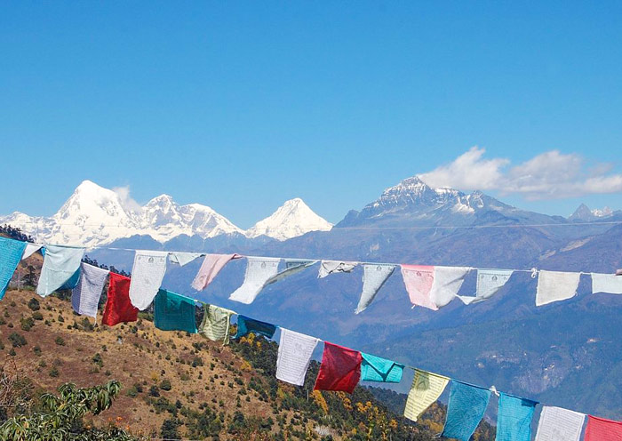
Bhutan's mountain roads cross several spectacular high-altitude passes. They are not only key transit points but also scenic highlights of the journey.
| Pass Name | Elevation | Location | Highlights |
|---|---|---|---|
| Dochula Pass | 3,100 m / 10,200 ft | Thimphu ➝ Punakha | 108 chortens, panoramic Himalayan views, popular photo stop |
| Pele La Pass | 3,420 m / 11,220 ft | Wangdue ➝ Trongsa | Border of western & central Bhutan, prayer flags, mountain views |
| Yotong La Pass | 3,425 m / 11,237 ft | Trongsa ➝ Bumthang | Entrance to spiritual Bumthang, scenic pine forests, peaceful atmosphere |
| Thrumshing La Pass | 3,780 m / 12,400 ft | Bumthang ➝ Mongar | One of the highest road passes, dramatic cliffs, winding roads, waterfalls |
| Kori La Pass | 2,450 m / 8,038 ft | Mongar ➝ Trashigang | Green hills, quiet stop, less touristy but very serene |
Bhutan Map Itinerary for First Timers
If it's your first time visiting Bhutan, this classic 6-day itinerary offers the perfect introduction to the kingdom's natural beauty and cultural treasures in Paro, Thimphu, and Punakha.
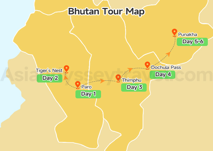
The map shows the travel routes, let's see some details with day by day itinerary.
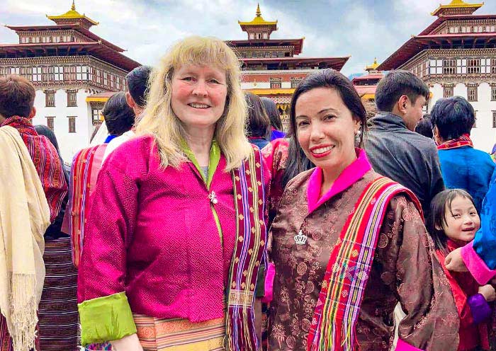
Day 1: You'll start by arriving in Paro, where you'll settle in and enjoy a scenic viewpoint over Paro Airport before getting a taste of Bhutanese culture by trying on traditional attire.
Day 2: The next day, get ready for one of Bhutan's most iconic experiences: the hike to Tiger's Nest Monastery, perched dramatically on a cliff. Afterward, visit the ancient Kyichu Lhakhang temple.
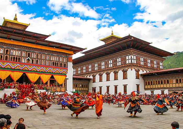
Day 3: You'll travel from Paro to the capital, Thimphu, stopping at Tamchog Lhakhang and its historic iron bridge. In Thimphu, highlights include Buddha Point, the National Memorial Chorten, the Takin Preserve, and the grand Thimphu Dzong.
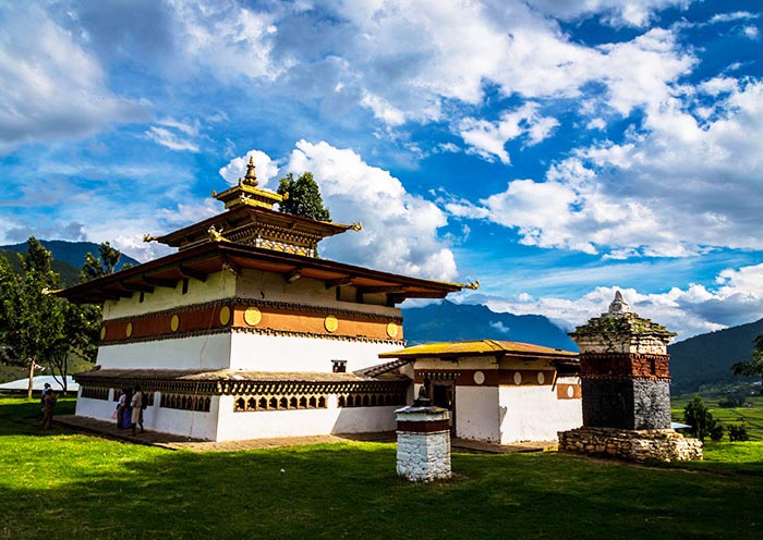
Day 4: Head toward Punakha via the scenic Dochula Pass, where panoramic Himalayan views await. Along the way, visit the fertility temple Chimi Lhakhang, then explore the majestic Punakha Dzong.
Day 5: Making time for a short hike to Khamsum Yulley Namgyal Chorten and a peaceful stop at Sangchhen Dorji Lhuendup Nunnery. Then journey back to Paro.
Day 6: You'll check out and head to the airport for your departure—bringing home unforgettable memories from the Land of the Thunder Dragon.